New App Aims to Help People with Blindness or Low Vision to Navigate NYC Subway
In an online research brief, New York University’s (NYU) Tandon School of Engineering highlighted the success of a new trip-planning app developed by researchers at NYU Tandon and NYU Grossman School of Medicine. The app has shown promising results in enhancing navigation within subway stations, presenting a potential solution for easier commutes for individuals with blindness and low-vision.
The app, known as the Commute Booster, not only guides users through the "first" and "last" miles of their journey but also navigates them through the "middle mile" within subway stations and transit hubs.
The study's findings were published in the IEEE Journal of Translational Engineering in Health and Medicine by Junchi Feng, PhD (Candidate), and other researchers. The research team, led by John-Ross Rizzo, MD, an associate professor in NYU Tandon's Biomedical Engineering department and a faculty member at NYU Grossman, included advisors from New York City's Metropolitan Transit Authority. Funding for the research was provided by the National Science Foundation, the National Eye Institute, the Fogarty International Center, and the US Department of Defense.
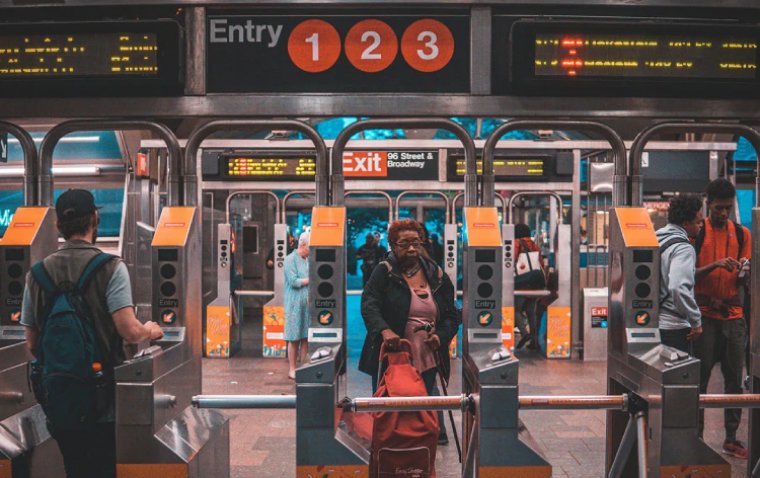
“The ‘middle mile’ often involves negotiating a complex network of underground corridors, ticket booths, and subway platform—it can be treacherous for people who cannot rely on sight,” commented Dr. Rizzo in the NYU Tandon research brief. “Most GPS-enabled navigation apps address ‘first’ and ‘last’ miles only, so they fall short of meeting the needs of blind or low-vision commuters. Commute Booster is meant to fill that gap.”
Moreover, the article pointed out that subway signs are typically graphical or text-based, creating difficulties for the visually impaired to recognize them from a distance, thus reducing their ability to navigate independently in unfamiliar environments.
The Commute Booster app is designed to address this challenge by automatically determining the signs a traveler will encounter on their way to a specific subway platform. It leverages a smartphone's camera to recognize and interpret signs inside transit hubs, filtering out irrelevant ones and guiding users to follow only relevant signs.
During the study, the Commute Booster app showcased an impressive 97% accuracy in identifying signs crucial to reaching the intended destination. Additionally, it could "read" signs from expected physical positions and angles, making it easier for users to navigate effectively.
The Commute Booster system relies on two technological components. The first is the general transit feed specification (GTFS), a standardized way for public transportation agencies to share transit data with developers and third-party applications. The second component is optical character recognition (OCR) technology, enabling the translation of text images into editable text.
By combining GTFS's dataset, which contains descriptions of locations and pathways within subway stations, and OCR functionality, Commute Booster generates a comprehensive list of wayfinding signage within subway stations for users' intended journeys. The algorithm identifies relevant navigation signs and their positions in the immediate surroundings.
Integrating these two components, Commute Booster provides real-time feedback to users about the presence or absence of relevant navigation signs within their phone camera's field of view during their journey.
Additionally, a further study of Commute Booster is scheduled for the near future, and the app is expected to be available for public use soon, as noted in the NYU Tandon article.
(1).jpg)
